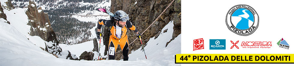

DESCRIPTION OF THE COMPETITIVE ROUTE:
1st climb: from the starting line at the valley station for the Col Margherita cable car lift (1871 m), first climb along the trail among the larch trees and then follow the marked route on the open, not-too-steep slope up to Col de le Palue (2266 m).
Area for changing into downhill mode.
1st descent: short downhill on an open, gentle slope to the flat village of Scalet – Ciamp de Ors (2136 m).
Area for changing into uphill mode.
2nd climb: in a majestic atmosphere it starts as a zigzag up to Forcella di Bocche and then to the summit of the namesake peak over the steep southwest crest (2745 m).
Area for changing into downhill mode.
2nd descent: gentle at first, down to the entrance of the steep north-eastern gully, to be undertaken extremely carefully, (this part of the descent will require the aid of safety cords and there will be guides on site); then pass under Forcella Grande di Juribrutto for a wide, steep slope back down to the flat resort of Scalet – Ciamp de Ors (2136 m).
Area for changing into uphill mode.
3rd climb: very short and easy trek up to Col de le Palue (2266 m).
Area for changing into downhill mode.
3rd descent: very short and easy downhill on a wide slope to the resort of Le Palue (2190m).
Area for changing into uphill mode.
4th climb: zigzag along the steep northern gulch of Forcella Vallazza, and then forge ahead along an easy crest up to the highest point at Lastè di Pradazzo (2580 m).
Area for changing into downhill mode.
4th descent: not too steep at first, then it becomes more challenging along the steep northern slope among jutting rocks (proceed with extreme caution) down to the entrance of the “Holzer” gully (2320 m).
Area for changing into uphill mode.
5th and last climb: a steep stretch to take on first in a zigzag pattern and then on foot with skis carried in a backpack through the “Holzer” gulch (uphill stretch using safety cords and with guides on site) and finally with skis on it’s an easy climb to the top of Col Margherita (2550 m).
Area for changing into downhill mode.
5th descent: on a steep and difficult northern face (Freeride route marked out with posts) down to the arrival at the valley station for the Col Margherita cable car lift (1871 m).

ALTITUDE CHANGES and DISTANCES
1st climb: m 395 – km 3.61
1st descent: m 130 – km 0.65
2nd climb: m 609 – km 1.91
2nd descent: m 609 – km 1.51
3rd climb: m 130 – km 0.65
3rd descent: m 76 – km 0.84
4th climb: m 390 – km 1.58
4th descent: m 260 – km 0.78
5th climb: m 230 – km 0.50
5th descent: m 679 – km 1.59
PLEASE NOTE: GATE HOURS
Racers have 2 hours from the official start of the race to make it to the GATE set up at Col de Le Palue ( 2266 m), located at the 5th skins change before the final descent to Le Palue. Competitors who have not passed the gate within the established time limit will return directly to the Arrival area (at the bottom of the Col Margherita cable car lift) along the route of the first climb.


.jpg")
-2")
-2")